Showing posts with label forest fires. Show all posts

Monday, 1 October 2012

Chulilla - The Aftermath.

Hiya!
Without any preamble let's get straight to the business in hand.........yesterday I finished after having just visited Chulilla.  But now it was time to see what damage had been done elsewhere.

Again there was no real possibility of getting up close and personal the fires, so I opted for the next best thing and left the CV35 to take a mud track which ran more or less parallel to the highway so that we were driving through a thin band of woodland that lies sandwiched between the highway and the fires.

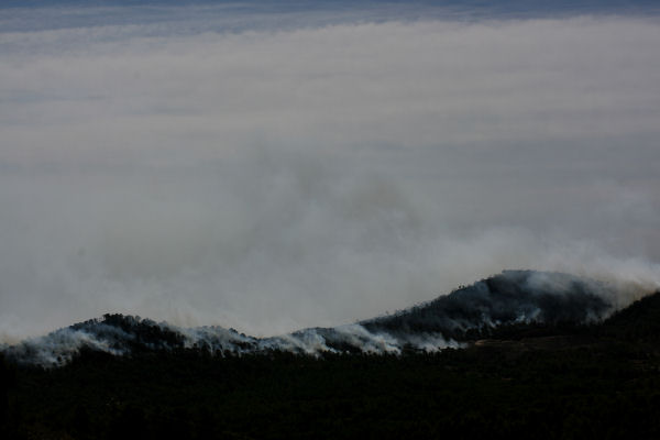
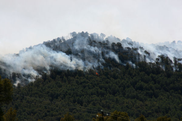
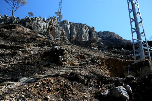
As we drove down the track it soon became very obvious that the extent of the destruction was far more apparent and widespread than it had been around Chulilla.  Fires were visible at almost every turn of the track - to try and estimate the number of blazes would be impossible and again we stopped to watch the disaster unfolding before our eyes (Figures 1-3).


Figure 1.  The tops of almost every hill and ridge were swathed in smoke.  This was just one of many sadly.


Figure 2.  The wind was still blowing a gale and occasionally we saw the fires flare bright orange as the wind whipped it into a fury.


Figure 3.  This fire was burning its' way back down the slopes of the ridge against the wind.

The whole thing was depressing and sad.  After a time I couldn't stand it any longer and went home.

I don't know exactly how many fires we had had locally during this summer but however many it was, it was way too many.  The TV said this fire had destroyed about 7,000 hectares in the end.  The big fire at Andilla earlier this summer 70,000 hectares.  But it seemed that almost every day a new fire was being reported on the local news, many of them small, manageable and perhaps charring only a few hundred hectares - hardly worth mentioning in the scale of things - but some days there were 5, 6 or more of these happening.  

When I stand on my terrace and decide which route I am going to cycle that particular day, I think about the wind direction, the temperature and also the beauty that I may get to take in.  Now, it doesn't matter which way I go, if I want to cycle mountain routes locally, then every single direction has been burned to a crisp this summer.  There isn't a single route that isn't charred, stinking and ravaged.

Climate change has Spain towards a much drier, hotter future.  Some say that within 50 years large parts of Spain will be reclassified as desert regions.  As Murphy's Law would have it, 2 days after making the rounds and taking the photos above, the drought which had lingered on for just a few days short of 18 months, broke and the past weekend we were treated to rainfall on a massive scale - which in itself caused flooding, deaths and more mayhem.  But that, as they say, is another story.

The rain has finally put paid to the threat of fires until next year, when it may all start again.  I realise how lucky we have been this year in truth.  Our tiny valley was the only region left untouched by fire this summer and despite their close proximity the fires did not affect us directly.  But will we be as lucky again next summer?

The rain continued to fall in torrents for 3 days and finally doused the last remaining fires around Chulilla and Pedralba.  But the cost had been high, for the environment, the Spanish pocket and the people who have been affected by the fires.  When the rain abated yesterday I went off to see the damage.


Figure 4.  1.- Chulilla.
2.- The factory where the fire is thought to have started.  
The big flat-topped mountain is now bald.  There is nothing left.


Figure 5.  Normally lush and verdant in the valley with the mountains swathed in shrubs and small pines.  Now again...... all gone.


Figure 6.  The river valley below Chulilla was a favourite place for tourists.  There were countless places beside the river for picnic and/or swimming.  It was always shady, verdant and pleasant with banks overcrowded with bamboo growing to the height of a house.  But today, all the bamboo is gone, the river banks are thick with ash and the water is polluted.


Figure 7.  The factory where the fire may have started.  Amazingly it looks untouched!


Figure 8.  The factory is set in the side of the valley with Chulilla behind it and the flat-topped mountain in front.  All the trees you see here are dead.


Figure 9.  The flat-topped mountain in close up....you can see all there is left are blackened rocks and charred soil. 


Figure 10.  Chulilla before the fires.....I hope you can see clearly how the mountains are covered in vegetation.
1.- Chulilla.
2.- The factory.


Figure 11.  The mountain now devoid of life.


Figure 12.  Black, black and more black.


Figure 13.  Not a hugely spectacular photo but one that illustrates the new status quo around Chulilla.


Figure 14.  This is an area of national park, a place of beauty and serenity and a fine place for a walk.  But now that is ended.  In every direction the story was the same - destruction!  The area seen here is normally a small parkland place with benches, tables and BBQ areas - but no more! 

Tomorrow I shall go over to Pedralba, Bugarra and Gestalgar to survey the damage.  I'll be back with that news very soon.

Ciao!


Sunday, 30 September 2012

Forest fires ravage beautiful Chulilla. More news....

Hey!
Carrying straight on from yesterday......the following morning I got up before day break to go to the top of the highest spot around....near us, anyway..... there's a track to the top which is almost drivable, so at 5.30am on the 24th I got up, drove halfway up the track, and then after that it was walking the steepest part, torch in hand, cameras and tripod on my back.  The wind was still howling and as I neared the top and became more exposed the wind became ever more vicious.

When I finally made it to the top I could see the fires still blazing, further away from me now, much further - which I guess was a relief in itself, but not much of one - because the flames were surely now engulfing Pedralba to the south and the ravines and valleys around Chulilla to the north.

The TV later said that Pedralba had also been evacuated and the pictures showed some burned out houses and cars.  Terrible scenes!  One rather poignant scene was of a young guy, 30ish, who'd invested in bees to make some money but also to help the environment.  He lost everything and was shown surveying the charred remains of his hives.

Okay, so no-one died, and in the scale of things the loss of few beehives is not a major disaster and maybe that's true.  But I wouldn't have liked it to have been me!  Many others lost houses, businesses, crops and much, much more.  Perhaps the only good news, so far as I know, no-one died.

Small mercies, eh?

So, back on the mountain I surveyed the scene.  Everywhere was very smoky and that obscured the view a lot, but by way of comparison I had actually been to this very spot the evening before the fire had started and so I knew that from where I stood normally I could see, even on a hazy day, at least 30kms.  But today, no!  The sun was not even beginning to show and I should have been able to see the lights of many of the local pueblos (Figure 1.) but as it was I could barely see fifth of that distance (Figure 2.)


Figure 1.  Shot the evening before the fire started you can see clearly the lights of Lliria and Benisano at the top of the scene.  It had been hot, 35 plus, that day and it was hazy.  On a clear day (for reference purposes!) you can see the city, harbour and ocean in detail.  The stripe of white down the middle is the traffic on the CV35, the main highway to Valencia.  In the foreground to the right of the CV35 are the lights of Domeno.


Figure 2.  I have shifted the camera angle and I am also taking a much wider look here but the view is basically the same.   On the right now is the CV35 withe lights of Domeno visible and on the right are the approaching fires.  Everything beyond was not visible.

As the sky started to brighten I could see that the reason for the obscured view was as I had feared.  It was all smoke (Figures 2, 3 & 4.) from one side of the plain to the other.  As it rose the fires were even tinting the smoke red.  At first I thought it was the sun, but it didn't appear for another half an hour so it couldn't have been.


Figure 3.  The same camera angle as before.


Figure 4.  On the left here is Casinos, the nearest pueblo to us on the way into the city.  On the left the eerie red smoke cloud hangs above Domeno.


Figure 5.  The cloud went high enough to cause the approach routes to the city airport to be altered temporarily.

To the north the fires had not advanced as far but still sent up its fair share of the smoke.  It was clear now that he area surrounding Chulilla was burning (Figure 6.) with the smoke being swept along by the wind with fast moving clouds above (Figure 7.)


Figure 6.  A single plume of smoke rises from Chulilla and spreads itself across the plain.


Figure 7.  As the sun finally rose the smoke looked like low lying clouds except that I could smell the burning even from where I was!

I left the mountain top with a heavy heart.  I needed to go and see if things were as bad I imagined.  I wasn't hopeful as I plodded back down the track for 'me brekky'.  I just had to cross everything and hope.

An hour or so after eating I set off again with the trouble and strife navigating!  Luckily I knew where we were going so, Phew!, that was a relief!! - It's important to retain a sense of humour in troubled times, and I'd demonstrated my sense of humour perfectly by allowing the Missus along!!  (Only joking baby if you read this!  No violence - please!)

Seriously now - We headed off down the road towards Villar del Arzobispo, then on to Llosa del Obispo.  I knew that by now all the approach roads to Chulilla would be closed down so we wouldn't be able to get very close.  And so it proved....as we went through Llosa the through-road was blocked off by the Guardia.  There were scores of people there watching as helicopters dumped load after load of water as the flames chewed up the mountains surrounding Chulilla (Figures 8-13.).


Figure 8.  This flat-topped mountain, a famed place locally to watch the sunset, was completely black.


Figure 9.  The fires were now charging down the lower slopes of the mountain.


Figure 10.  It was horrible to watch.  Normally I cycle past where the road block is and down the side of the valley to sweep round where the fires now blazed and into the back of Chulilla the opposite side of the black mountain.


Figure 11.  Helipcopters kept dropping their cargo but the effect seemed little from this distance.  However, now, having been down that road (tomorrows blog) I can see that I was wrong.  The fire made it as far as the road in odd places but in the main the helicopters appear to have arrested the fires before they could get close to the road and the town itself.


Figure 12.  1.- Just round where the arrow indicates lies the pueblo of Chulilla.
2.- The Chulilla ravine where we go to swim.  Absolutely beautiful and very close to the flames.
3.-  The top of the next mountain after Chulilla was blackened as well.  There is a small mountain pass over there that leads down to Sot de Chera which the TV had said was also in danger.  I have yet to see for myself.


Figure 13.  A tragedy to behold.

Back tomorrow with more.  See ya!

Friday, 28 September 2012

Forest fires ravage beautiful Chulilla - Thousands more hectares destroyed.

Hiya!
I've been missing for a while, but no apologies.......some things are more pressing than writing a blog!

And straight away it's back to the same old story I'm afraid.  During the afternoon of the 23rd my neighbour pottering about on his roof called my attention to a huge pillar of smoke rising up behind our houses (Figure 1.) and as you can see from the photo it looked like it was just the other side of the hill!  'Bloody hell!,' I thought, 'not again!'

I jumped on my bike immediately and set off to investigate.  The Poniente, the name given to the prevailing wind, had been blowing exceptionally strongly all day, and cycling into that wind to get in a position where I could see the fire was like riding with the brakes on, but within minutes it became obvious to me that the fire was farther away than I had originally thought.  Phew!  But then....shit....I could see the mountains opposite me, looking south-east, some 7 or 8kms away, were aflame, and even as I watched the wind was whipping the fire up, egging it on to take a bite of the next tree, and the next, and the next.  But strangely the fire wasn't only progressing in the direction of the wind - almost due south - but was also working its way northwards so that thsoe flames were heading almost directly towards the holiest of holies - Chulilla.

Chulilla is one of the village gems locally, a charming pueblo tucked away in a picture postcard ravine and what's more, almost the last remaining of my favourite cycling haunts that had not been burned to a crisp this summer!  I couldn't believe it.  I went back home feeling somewhat relieved that the fire was the other side of the highway and would probably not be able to make the jump across, but at the same time I was sick at the destruction that would undoubtedly follow in the days to come.  I wish I could say that that feeling had been misguided, but sadly it wasn't.


Figure 1.  The time was 5.26pm on the 23rd.  And the house you can see is my neighbours.


Figure 2.  Convoys of emergency vehicles rolled past...hundreds of them.....


Figure 3. .....as others have finished for the night and head off home.

Later that night after we'd eaten we jumped in the car and set off to see how things were going.  It was about 11 when we parked up the first time on the lower slopes of a small mountain behind our neighbours house.  he red glow had been plainly visible from our house so as walked up to gain a better prespective I feared the worst.

The wind was still howling and I had to literally stand on the feel of my tripod to keep it from blowing over - I kid you not!  As we had made the short climb I had not looked behind me deliberately, as if not looking might make it not so bad when I eventually did look.  But I don't think it worked, because when I turned round the devastation was immense.  

Standing a few hundred meters further away than I had been earlier on my bike I still couldn't fit all the fires into a single 18mm camera shot!  Instead of the single fire I'd seen some four hours earlier, I now saw a string of fires that stretched out over 11kms of mountain and ridge tops.  

To the south, the fires had moved rapidly having been fanned by the winds and appeared to be descending on the areas around Bugarra, Gestalgar and maybe Pedralba, all beautiful, all rich in agriculture and also peppered with the residences of many ex-pats, some of whom I know (Figures 4 & 5.).  It was unreal how far the fires had moved, the lives it must have already destroyed.  I just turned away to look in the opposite direction.  It's hard to know what to think a those times.


Figure 4.  These fires were furthest away from where we stood, maybe 8 or 9kms.  To the naked eye the flames were clearly visible but to capture it with camera I had to use a long exposure, hence the furry fires!  These flames appeared to be moving on Domeno.


Figure 5.  This line of fire appeared to be moving on Bugarra, Gestalgar and Pedralba.

But it was no better to the north.  The fires there had not moved so rapidly but they were definitely very, very close to Chulilla if not on top of it (Figure 6.) - I later found out that the pueblo had already been evacuated and was in the same school where the evacuees from the previous fires had been, the college in Villar del Arzobispo only 3 kms to my right as I stood.  The volunteers there deserve medals!


Figure 6.  Chulilla was burning as the moon shone above.  I just hoped no-one was hurt.


This fire was closest to us and so appeared to burn the brightest, though my heart was descending into darkness.  Chulilla and perhaps Sot de Chera, two of the most beautiful places I have ever seen were being altered forever before my eyes.  And not, most certainly not in a good way.

More tomorrow.

Thursday, 9 August 2012

Forest Fires in Spain - A Look at the Facts

Hiya!
I've been somewhat distracted of late with the Olympics, as I guess have one or two of you.  It's always been the same with me as far as the Olympics are concerned......I just cannot get enough and spend unreasonably long hours cheering, crying, and enjoying this feast of sport.  But there are enough things written about this without me adding my tinpot analyses.  So instead I'm going to return to a subject that has been making the news on a daily basis in Spain this summer and one that I too have covered in some detail.

Forest fires or wildfires are ravaging Spain this summer.  Every day the local news carries details of some new outbreak in the locality.  The national news too covers the larger fires that are by no means limited to our locality, Valenciana, but are occurring nationwide.  Spain it seems is suffering an epidemic of fires this year as a result of limited or little rainfall and higher than normal early summer temperatures.  And as you may know, we had a particularly large forest fire blazing near us recently - in fact to my knowledge, in terms of the area destroyed, it is still the largest fire in Spain this summer - and this started me asking questions.

Before this recent episode I didn't have any experience whatsoever of wild or forest fires.  Before moving to Spain this was merely something terrible that happened in those parts of the globe that most of us only visit for our holidays.  They were not something that I had to be particularly troubled about, as awful and destructive as they can be.  But when we saw that huge pillar of smoke just behind our house forest fires immediately became something that can now impact very heavily on our lives, and that stirred me to start asking some questions.

Why are there so many fires in Spain?  Is this just a normal state of affairs here or is this year the veritable annus horribilis for the forests of the Iberian peninsula?  Are there records detailing the state of the forests in Spain with regard to numbers and frequencies of fires in Spain?  The fire behind us destroyed an estimated 70,000 hectares of forest - now to me, that seems an awful lot.  Is it possible that the total area of forest in Spain is unsustainable given the current level of incendios in the region?

This is a complex investigation and one that may well take some time to complete fully, but that said, maybe it is an something that needs doing.  Questions need to be asked because this is surely a situation that cannot continue.

So, let's start with some basic facts.  I'll try to provide evidence to back up my 'facts' and I will endeavour to say when an observation or data point is anecdotal rather than a proven point of fact.

The facts:

Spain does not have high rainfall (see Table 1 at the bottom.  Data from the World weather service and refers to the Valencia region and not Spain as a whole) and this as much as anything else must have a serious effect on the number, size and distribution of forest fires. As a consequence, since 1993 the Spanish Meteorological Office have been producing a daily map (see an example of this type of map in Figure 1.) that assesses the daily risk (of forest fire) for each and every region of the country, the aim being to offer support to the various agencies that work to prevent and fight the fires.

Figure 1.  An example of the type of map produced each day by the Agencia Estatal de Meteorología to assess the risk of a forest fire occurring.

As you can see from the map the region around Valencia is classified normally as an area of 'muy alto' or very high risk.  But how does this translate into actual fires? 

Figure 2 (below) was compiled by United Nations Economic Commission for Europe and shows (on the left) the average density of forest fires per year per sq.km  (apologies if the figures seem a bit small but it's the largest I can make it).  As you can see, compared to Europe as a whole the Mediterranean region has a much higher incidence of fires than the more temperate, wetter regions to the north.  The areas of dark red have an incidence of fires above 0.61 making it slightly greater than a bi-annual occurrence in these places.  The map on the left shows the percentage of land that is burned on an annual basis as a percentage of the total forest as a whole.  You will see the two maps are almost interchangeable and that the incidence and consequences of the fires in areas of high risk appear to be strongly linked.  Around the Valencia area the two maps are again comparable with an incidence of fires of between 0.21-0.60 and an average percentage burned each year of up to 0.91% of the total forest area, which I admit doesn't sound like awful lot.
Figure 1.  Average forest fire density and average burned forest fraction in Europe (1998-2007).

It makes sense that areas with higher rainfall would suffer a much diminished risk when compared to areas of relatively low rainfall.  With that in mind, let's take a closer look at the Mediterranean region as a whole.  Figure 2 (all graphics taken from the UN site ) below shows the numbers and amount of forest destroyed each year in the Mediterranean region.  The left-hand graph shows the area (in thousands of kms) between 1980 and 2008.  You will note that the area destroyed by fires has not gone up in the region and may even have fallen slightly over the listed period, but without the raw data and a stats enabled computer I cannot say this for sure.  The right-hand graph lists the number of fires which shows a definite rise during the 90's and the early part of this century, but does appear to have fallen slightly in more recent years.

 Figure 2.  Number of fires and burnt area in the EU-Mediterranean region.

Figure 3.  Number of fires and burnt area in the non-Mediterranean region of the EU.

If we now take a look at the non-Med region of the EU (Figure 3) the first thing that jumps out is that the amount of forest lost outside the Med is far, far lower than around the Med.  The worst year (left-hand graph) listed is 2000 when an estimated 120,000 kms of forest in the non-Med region were lost (I had no idea that the figures would be quite this large and to say I'm slightly horrified is to put it mildly).  But compare that now to the best year for the Med, when in 2008 180,000 kms were lost (Figure 2).  More than 50% more than northern Europe and that is the BEST year listed.  In the worst year (1985) over a million hectares were lost but with an average well in excess of the cooler Northern regions.  However, whilst the numbers of fires in the non-Med region (Fig. 3. right-hand graph) is lower than around the Med itself, the numbers are infinitely more comparable.

As for Spain as an independent data point, the number of fires annually has increased from just over 13,000 in 1991 to just below 20,000 by 2001 (the last year of exact figures published by the UN right now) with a high of 26,000 in 1995.  Portugal too has seen a similar but slightly more extreme rise in the numbers of fires from 13,000 to over 26,500 for the same period with any high or bad years being tied to those witnessed in Spain.  This would imply that any root causes in the incidence of fires for the Iberian peninsula as a whole are uniform and may well be meteorologically related. 

As a comparison the incidence of fires in Italy actually shows a trend towards a decrease during the same period from 11695 down to 7134.  As a personal observation Greece, which has a similar climate to Spain has but a fraction of the number of fires that we see here.  The average number of fires between 1991 -2001 inclusive (i.e 11 years of data published by the UN) in Spain was 19203 compared to Greece's 4558, a figure almost 75% less.

In terms of actual area destroyed the UN figures include all land, be it forested, woodland or otherwise.  During the period 1991-2001 inclusive the average area destroyed in Spain was 152122 hectares (ranging from 59842 in 1996 to a high of 437635 in 1994).  In Italy the average was 110437 hectares (range 48884 to 195179) and in Greece 56117 hectares (range 13046 to 167006).

Data on the percentage of actual woodland destroyed is only published for the final 3 years (1999-2001) making conclusions on this more difficult.  In Spain in 1999 a massive 94.5% of the land destroyed was forested of which 29% was listed as 'high forest' (though the altitude above which a forest becomes high forest is not detailed).   In 2000 the percentage burned dropped to just over 91% (24% high forest) and in 2001 dropped again to 20.7% of which all was 'high forest'.

The causes of forest fires in Spain, as elsewhere, are many and may range from human causes (negligence, arson or some other criminal activity) to natural causes (high ambient temperatures) though the root of many may remain unknown.  In 1999 just under 71% and in 2000 76% of fires in Spain were attributed to arson, though an exact breakdown on these figures is unavailable.  If anyone has data on the number of convictions resulting from these figures it would be appreciated.  Of the remaining fires (29% and 24% respectively for 1999 and 2000) 12% and 9.5% were attributed to accidents (or negligence) with agricultural machinery and <1.9% and <1.3% to logging and forestry operations.  Data for Italy and Greece are unavailable for comparison. 

In Spain, by far the majority of land is destroyed as a result of criminal activities (86%, 90% and 49.8% respectively for 1999-2001 inclusive) which is a worrying statistic if nothing else.

In their 'Fire Management - A Global Assessment' booklet the UN confirm that the 'forest fire situation in the Mediterranean basin is largely determined by climatic conditions'.  Long summers with prolonged high temperatures above 30C reduce the moisture content in forest litter (pine needles and the like) to less than 5%.  'Under these conditions even a small addition of heat (lightning, a spark, a match, a cigarette) can be enough to start a violent conflagration'.  

The wind too plays it's part with the summer winds desiccating the parched land and the winter winds also blowing dry but cold.  City dwellers also apparently show 'a particularly poor understanding of the dangers of fires and their potentially negative consequences' and many fires result from the burning of waste during recreational activities. However the numbers of fires caused deliberately with a destructive intent is also on the rise with some of these arising from the want of a particular individual to 'change the land-use classification'.

And here I shall end this rather long blog entry.  I shall continue in the next entry with further analyses of this growing problem.

Thanks for reading
P XX

Table 1.  Climatological Information from the World Weather Service
Month Mean Temperature oC Mean Total Precipitation (mm) Mean Number of Precipitation Days
Daily
Minimum
Daily
Maximum
Jan 7.0 16.1 36 6
Feb 7.9 17.2 32 6
Mar 9.0 18.7 35 6
Apr 10.8 20.2 37 7
May 14.1 22.8 34 8
Jun 17.9 26.2 23 5
Jul 20.8 29.1 9 2
Aug 21.4 29.6 19 4
Sep 18.6 27.6 51 6
Oct 14.5 23.6 74 7
Nov 10.4 19.5 51 6
Dec 8.1 16.8 52 7